• Contact
    • AOI
    • Google Earth
    • Order
    • Technical Contact Form
    • Spanish Contact Form
    • Deutsch
    • Francais
    • Italiano
  • Satellites
    • WorldView-4 (0.31m)
    • WorldView-3 (0.31m)
    • WorldView-2 (0.46m)
    • WorldView-1 (0.46m)
    • GeoEye-1 (0.46m)
    • Pleiades-1A (0.5m)
    • Pleiades-1B (0.5m)
    • SuperView-1 (0.5m)
    • KOMPSAT-3A (0.55m)
    • KOMPSAT-3 (0.7m)
    • QuickBird (0.65m)
    • Gaofen-2 (0.8m)
    • TripleSat (0.8m)
    • IKONOS (0.82m)
      • IKONOS Stereo Imagery
    • SkySat-1 (0.8m)
    • SkySat-2 (0.8m)
    • Jilin-1 (1m)
      • Jilin-1 Optical Satellite
      • Jilin-1 Smart Video Satellite
      • Jilin-1 Hyperspectral Satellite
    • TerraSAR-X
    • SPOT-6 (1.5m)
    • SPOT-7 (1.5m)
    • Other Satellites (2m-20m)
      • FORMOSAT-2 (2m)
      • TH-01 (2m)
      • ALOS (2.5m)
      • CARTOSAT-1 (2.5m)
      • SPOT-5 (2.5m-5m)
      • Dove (3m)
      • RapidEye (5m)
      • Sentinel-2A (10m)
      • LANDSAT 7 ETM+ (15m)
      • LANDSAT 8 (15m)
      • ASTER (15m)
      • CBERS-2 (20m)
  • Gallery
    • WorldView-4
    • WorldView-3
    • WorldView-2
    • WorldView-1
    • GeoEye-1
    • Pleiades-1A
    • Pleiades-1B
    • KOMPSAT-3
    • QuickBird
    • IKONOS
    • SkySat-1
    • TripleSat
    • TerraSAR-X
    • SPOT-6
    • SPOT-7
    • TH-01
    • RapidEye
    • LANDSAT 7 ETM+
    • LANDSAT 8
    • High Resolution
    • Medium Resolution
    • 3D Terrain Flythroughs
    • 3D Terrain Modelling
    • Geographic Information Systems (GIS)
    • Historical Sites
    • More Imagery
      • ALOS
      • CARTOSAT-1
      • SPOT-5
      • Dove
      • Sentinel-2A
      • ASTER
      • CBERS-2
      • FORMOSAT-2
      • Aerial Photos
  • Applications
    • Energy
      • Mining
      • Oil and Gas
        • Oil and Gas Development
        • Oil and Gas Exploration
        • Oil and Gas Production
      • Pipeline and Transmission
    • Engineering and Construction
      • 3D Urban and Terrain Modeling
      • Airport Mapping Database
      • Cadastre and Land Records
      • Urban and Land Development
    • Defense and Security
      • Crime Mapping
      • Homeland Security
    • Environmental Management
      • Global Climate Change
      • Urban Planning
      • Conservation
        • Archaeology
        • Coastal Management
        • Habitat Mapping
        • Wildlife Monitoring
      • Land Cover and Change Detection
      • Natural Disasters
        • Hurricanes
      • Natural Hazards
        • Landslides
    • Media and Entertainment
    • Natural Resources
      • Agriculture Mapping
        • Agricultura
        • Vegetation Index Maps
          • Indice De Vegetacion Verde
        • GVI Sample Images
          • Agricultura Mapas
        • Soil Zone Index
          • Indoce de la Cubierta Vegetal
        • TreeGrading Maps
          • TreeGrading de Agricultura
      • Forestry
        • Control Remoto de Silvicultura
      • Soil Moisture and Ocean Salinity
    • Tourism
  • Services
    • 3D Terrain Modelling
    • ATCOR
    • Atmospheric Compensation
    • Consultancy
    • 3D Digital Elevation Model
    • Feature Extraction
    • Geographic Information Systems
    • Image Processing
    • Orthorectification
    • Resources
      • Geospatial Technology
      • Remote Sensing
  • About
    • Press
  • Press
  • Contact Us
Press Contact Us
Satellite Imaging Corporation
  • Satellite Imaging Corporation
  • Contact
    • AOI
    • Google Earth
    • Order
    • Technical Contact Form
    • Spanish Contact Form
    • Deutsch
    • Francais
    • Italiano
  • Satellites
    • WorldView-4 (0.31m)
    • WorldView-3 (0.31m)
    • WorldView-2 (0.46m)
    • WorldView-1 (0.46m)
    • GeoEye-1 (0.46m)
    • Pleiades-1A (0.5m)
    • Pleiades-1B (0.5m)
    • SuperView-1 (0.5m)
    • KOMPSAT-3A (0.55m)
    • KOMPSAT-3 (0.7m)
    • QuickBird (0.65m)
    • Gaofen-2 (0.8m)
    • TripleSat (0.8m)
    • IKONOS (0.82m)
      • IKONOS Stereo Imagery
    • SkySat-1 (0.8m)
    • SkySat-2 (0.8m)
    • Jilin-1 (1m)
      • Jilin-1 Optical Satellite
      • Jilin-1 Smart Video Satellite
      • Jilin-1 Hyperspectral Satellite
    • TerraSAR-X
    • SPOT-6 (1.5m)
    • SPOT-7 (1.5m)
    • Other Satellites (2m-20m)
      • FORMOSAT-2 (2m)
      • TH-01 (2m)
      • ALOS (2.5m)
      • CARTOSAT-1 (2.5m)
      • SPOT-5 (2.5m-5m)
      • Dove (3m)
      • RapidEye (5m)
      • Sentinel-2A (10m)
      • LANDSAT 7 ETM+ (15m)
      • LANDSAT 8 (15m)
      • ASTER (15m)
      • CBERS-2 (20m)
  • Gallery
    • WorldView-4
    • WorldView-3
    • WorldView-2
    • WorldView-1
    • GeoEye-1
    • Pleiades-1A
    • Pleiades-1B
    • KOMPSAT-3
    • QuickBird
    • IKONOS
    • SkySat-1
    • TripleSat
    • TerraSAR-X
    • SPOT-6
    • SPOT-7
    • TH-01
    • RapidEye
    • LANDSAT 7 ETM+
    • LANDSAT 8
    • High Resolution
    • Medium Resolution
    • 3D Terrain Flythroughs
    • 3D Terrain Modelling
    • Geographic Information Systems (GIS)
    • Historical Sites
    • More Imagery
      • ALOS
      • CARTOSAT-1
      • SPOT-5
      • Dove
      • Sentinel-2A
      • ASTER
      • CBERS-2
      • FORMOSAT-2
      • Aerial Photos
  • Applications
    • Energy
      • Mining
      • Oil and Gas
        • Oil and Gas Development
        • Oil and Gas Exploration
        • Oil and Gas Production
      • Pipeline and Transmission
    • Engineering and Construction
      • 3D Urban and Terrain Modeling
      • Airport Mapping Database
      • Cadastre and Land Records
      • Urban and Land Development
    • Defense and Security
      • Crime Mapping
      • Homeland Security
    • Environmental Management
      • Global Climate Change
      • Urban Planning
      • Conservation
        • Archaeology
        • Coastal Management
        • Habitat Mapping
        • Wildlife Monitoring
      • Land Cover and Change Detection
      • Natural Disasters
        • Hurricanes
      • Natural Hazards
        • Landslides
    • Media and Entertainment
    • Natural Resources
      • Agriculture Mapping
        • Agricultura
        • Vegetation Index Maps
          • Indice De Vegetacion Verde
        • GVI Sample Images
          • Agricultura Mapas
        • Soil Zone Index
          • Indoce de la Cubierta Vegetal
        • TreeGrading Maps
          • TreeGrading de Agricultura
      • Forestry
        • Control Remoto de Silvicultura
      • Soil Moisture and Ocean Salinity
    • Tourism
  • Services
    • 3D Terrain Modelling
    • ATCOR
    • Atmospheric Compensation
    • Consultancy
    • 3D Digital Elevation Model
    • Feature Extraction
    • Geographic Information Systems
    • Image Processing
    • Orthorectification
    • Resources
      • Geospatial Technology
      • Remote Sensing
  • About
    • Press
  • Search

    Energy

    Discover what's possible. Get a complimentary consultation today.
    Contact Us Now
    • Home
    • Applications

    Energy Industry Applications

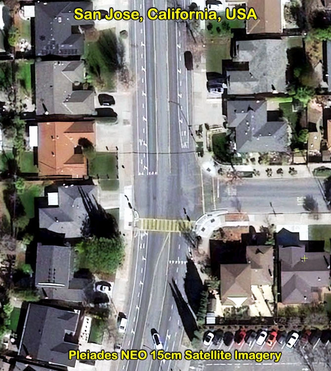
    Satellite Imaging Corporation (SIC) provides satellite image data at different spatial, spectral, and temporal resolutions by using the appropriate combination of bands to bring out the geographical and manmade features that are most pertinent to your project for detecting and monitoring changes.

    Oil & Gas

    Oil and Gas Exploration and Development

    Mining

    Satellite Map for Mineral Mapping

    Pipelines

    Pipeline Transmissions

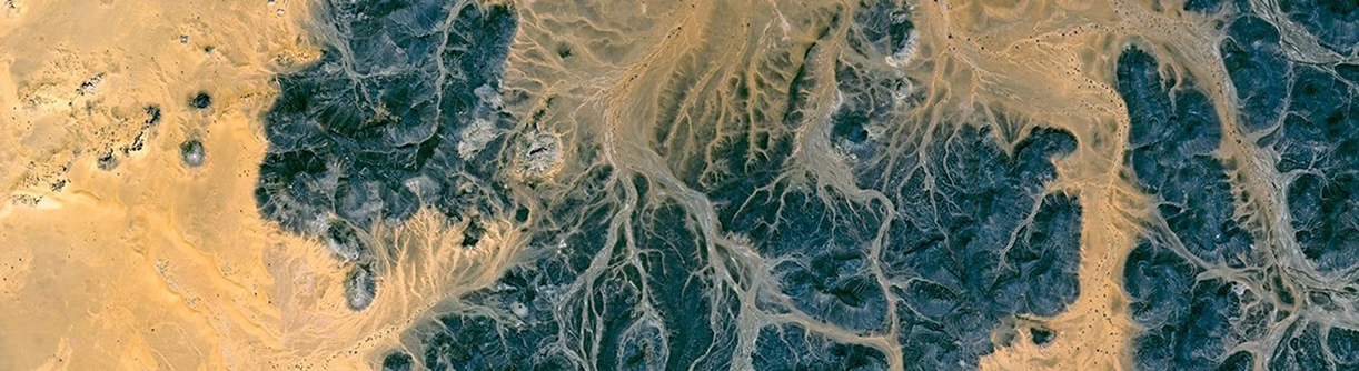
    The most established market in remote sensing is in the area of natural resources in exploration of oil, gas, and minerals. Remote sensing technology aids in the selection and development of oil and gas exploration areas around the world as well as in the areas of oil spill mitigation and remediation. Through geological and geophysical seismic interpretation and use of orthorectified satellite images, it provides insight on the selection of areas to plan 2D or 3D seismic surveys for an exploration drilling program as well as aiding in the process of environmental and operational safety hazards to minimize the HSE risks. There is currently no other technology that matches or exceeds the capabilities of remote sensing and its necessity in the energy industry.

    Satellite Imaging Corporation is an official Value Added Reseller (VAR) of imaging and geospatial data products for:
    A Twenty First Century Aerospace Technology Value Added Reseller
    Satellite imagery can be applied within many industries. Please choose one to learn more.
    • Energy
    • Engineering and Construction
    • Defense and Security
    • Environmental Management
      • Global Climate Change
      • Urban Planning
      • Conservation
        • Archaeology
        • Coastal Management
        • Habitat Mapping
        • Wildlife Monitoring
      • Land Cover and Change Detection
      • Natural Disasters
        • Hurricanes
      • Natural Hazards
        • Landslides
    • Media and Entertainment
    • Natural Resources
    • Tourism
    GeoEye-1 WorldView-1 WorldView-2 Pleiades-1A QuickBird IKONOS SPOT-6 SPOT-5 RapidEye ASTER LANDSAT-7
    • Contact
    • Satellites
    • Gallery
    • Applications
    • Services
    • About
      • Terms of Use
      • Privacy Policy
      • Site Map

    Copyright © 2001-2017 Satellite Imaging Corporation. All rights reserved.

    Facebook Twitter LinkedIn