Characterization of Satellite Remote Sensing Systems
The most common characterization of different satellite remote sensing (RS) systems results from the systems diverse spatial, temporal and spectral resolutions
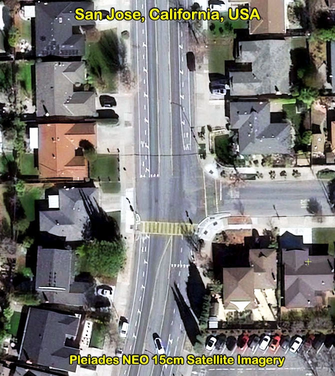
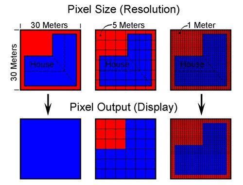
Spatial Resolution
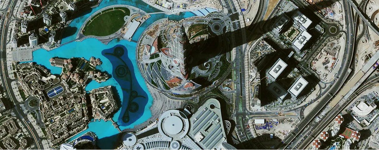
The spatial resolution specifies the pixel size of satellite images covering the earth surface.
High spatial resolution: 0.10m – 5m
Low spatial resolution: 6m – > 1000 m
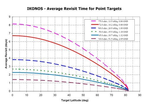
Temporal Resolution
The temporal resolution specifies the revisiting frequency of a satellite sensor for a specific location.
High temporal resolution: < 24 hours – 3 days
Medium temporal resolution: 4 – 16 days
Low temporal resolution: > 16 days
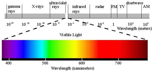
Spectral Resolution
In the first instance, a sensor’s spectral resolution specifies the number of spectral bands in which the sensor can collect reflected radiance. But the number of bands is not the only important aspect of spectral resolution. The position of bands in the electromagnetic spectrum is important, too.
High spectral resolution: – 220 bands
Medium spectral resolution: 3 – 15 bands
Low spectral resolution: – 3 bands
Resolution Trade-Off
The different spatial, temporal and spectral resolutions are the limiting factor for the utilization of the satellite image data for different applications.
Unfortunately, because of technical constraints, satellite remote sensing systems can only offer the following relationship between spatial and spectral resolution: a high spatial resolution is associated with a low spectral resolution and vice versa.
That means that a system with a high spectral resolution can only offer a medium or low spatial resolution.
Therefore, it is either necessary to find compromises between the different resolutions according to the individual application or to utilize alternative methods of data acquisition.
The trade-off may result in two different solutions:
- To lay emphasis upon the most important resolution, in direct dependency to the application, with the acceptance of low attendant resolutions at the same time, or
- To lay no emphasis on one specific resolution and at the same time the acceptance of a medium spectral, temporal and spatial resolution.
Consultancy
Ongoing Satellite remote sensing and GIS consultancy services are provided to our clients, including the set-up of reliable source coordinate databases in support of computerized mapping, exploration, and development of projects around the world and to clients implementing AI, ML, Computer Vision (CV) or GIS management systems, utilizing a variety of source data. For more information or for a consultation, please contact us.
For more information on any of our products and services or for a consultation, please contact us.