• Contact
    • AOI
    • Google Earth
    • Order
    • Technical Contact Form
    • Spanish Contact Form
    • Deutsch
    • Francais
    • Italiano
  • Satellites
    • WorldView-4 (0.31m)
    • WorldView-3 (0.31m)
    • WorldView-2 (0.46m)
    • WorldView-1 (0.46m)
    • GeoEye-1 (0.46m)
    • Pleiades-1A (0.5m)
    • Pleiades-1B (0.5m)
    • SuperView-1 (0.5m)
    • KOMPSAT-3A (0.55m)
    • KOMPSAT-3 (0.7m)
    • QuickBird (0.65m)
    • Gaofen-2 (0.8m)
    • TripleSat (0.8m)
    • IKONOS (0.82m)
      • IKONOS Stereo Imagery
    • SkySat-1 (0.8m)
    • SkySat-2 (0.8m)
    • Jilin-1 (1m)
      • Jilin-1 Optical Satellite
      • Jilin-1 Smart Video Satellite
      • Jilin-1 Hyperspectral Satellite
    • TerraSAR-X
    • SPOT-6 (1.5m)
    • SPOT-7 (1.5m)
    • Other Satellites (2m-20m)
      • FORMOSAT-2 (2m)
      • TH-01 (2m)
      • ALOS (2.5m)
      • CARTOSAT-1 (2.5m)
      • SPOT-5 (2.5m-5m)
      • Dove (3m)
      • RapidEye (5m)
      • Sentinel-2A (10m)
      • LANDSAT 7 ETM+ (15m)
      • LANDSAT 8 (15m)
      • ASTER (15m)
      • CBERS-2 (20m)
  • Gallery
    • WorldView-4
    • WorldView-3
    • WorldView-2
    • WorldView-1
    • GeoEye-1
    • Pleiades-1A
    • Pleiades-1B
    • KOMPSAT-3
    • QuickBird
    • IKONOS
    • SkySat-1
    • TripleSat
    • TerraSAR-X
    • SPOT-6
    • SPOT-7
    • TH-01
    • RapidEye
    • LANDSAT 7 ETM+
    • LANDSAT 8
    • High Resolution
    • Medium Resolution
    • 3D Terrain Flythroughs
    • 3D Terrain Modelling
    • Geographic Information Systems (GIS)
    • Historical Sites
    • More Imagery
      • ALOS
      • CARTOSAT-1
      • SPOT-5
      • Dove
      • Sentinel-2A
      • ASTER
      • CBERS-2
      • FORMOSAT-2
      • Aerial Photos
  • Applications
    • Energy
      • Mining
      • Oil and Gas
        • Oil and Gas Development
        • Oil and Gas Exploration
        • Oil and Gas Production
      • Pipeline and Transmission
    • Engineering and Construction
      • 3D Urban and Terrain Modeling
      • Airport Mapping Database
      • Cadastre and Land Records
      • Urban and Land Development
    • Defense and Security
      • Crime Mapping
      • Homeland Security
    • Environmental Management
      • Global Climate Change
      • Urban Planning
      • Conservation
        • Archaeology
        • Coastal Management
        • Habitat Mapping
        • Wildlife Monitoring
      • Land Cover and Change Detection
      • Natural Disasters
        • Hurricanes
      • Natural Hazards
        • Landslides
    • Media and Entertainment
    • Natural Resources
      • Agriculture Mapping
        • Agricultura
        • Vegetation Index Maps
          • Indice De Vegetacion Verde
        • GVI Sample Images
          • Agricultura Mapas
        • Soil Zone Index
          • Indoce de la Cubierta Vegetal
        • TreeGrading Maps
          • TreeGrading de Agricultura
      • Forestry
        • Control Remoto de Silvicultura
      • Soil Moisture and Ocean Salinity
    • Tourism
  • Services
    • 3D Terrain Modelling
    • ATCOR
    • Atmospheric Compensation
    • Consultancy
    • 3D Digital Elevation Model
    • Feature Extraction
    • Geographic Information Systems
    • Image Processing
    • Orthorectification
    • Resources
      • Geospatial Technology
      • Remote Sensing
  • About
    • Press
  • Press
  • Contact Us
Press Contact Us
Satellite Imaging Corporation
  • Satellite Imaging Corporation
  • Contact
    • AOI
    • Google Earth
    • Order
    • Technical Contact Form
    • Spanish Contact Form
    • Deutsch
    • Francais
    • Italiano
  • Satellites
    • WorldView-4 (0.31m)
    • WorldView-3 (0.31m)
    • WorldView-2 (0.46m)
    • WorldView-1 (0.46m)
    • GeoEye-1 (0.46m)
    • Pleiades-1A (0.5m)
    • Pleiades-1B (0.5m)
    • SuperView-1 (0.5m)
    • KOMPSAT-3A (0.55m)
    • KOMPSAT-3 (0.7m)
    • QuickBird (0.65m)
    • Gaofen-2 (0.8m)
    • TripleSat (0.8m)
    • IKONOS (0.82m)
      • IKONOS Stereo Imagery
    • SkySat-1 (0.8m)
    • SkySat-2 (0.8m)
    • Jilin-1 (1m)
      • Jilin-1 Optical Satellite
      • Jilin-1 Smart Video Satellite
      • Jilin-1 Hyperspectral Satellite
    • TerraSAR-X
    • SPOT-6 (1.5m)
    • SPOT-7 (1.5m)
    • Other Satellites (2m-20m)
      • FORMOSAT-2 (2m)
      • TH-01 (2m)
      • ALOS (2.5m)
      • CARTOSAT-1 (2.5m)
      • SPOT-5 (2.5m-5m)
      • Dove (3m)
      • RapidEye (5m)
      • Sentinel-2A (10m)
      • LANDSAT 7 ETM+ (15m)
      • LANDSAT 8 (15m)
      • ASTER (15m)
      • CBERS-2 (20m)
  • Gallery
    • WorldView-4
    • WorldView-3
    • WorldView-2
    • WorldView-1
    • GeoEye-1
    • Pleiades-1A
    • Pleiades-1B
    • KOMPSAT-3
    • QuickBird
    • IKONOS
    • SkySat-1
    • TripleSat
    • TerraSAR-X
    • SPOT-6
    • SPOT-7
    • TH-01
    • RapidEye
    • LANDSAT 7 ETM+
    • LANDSAT 8
    • High Resolution
    • Medium Resolution
    • 3D Terrain Flythroughs
    • 3D Terrain Modelling
    • Geographic Information Systems (GIS)
    • Historical Sites
    • More Imagery
      • ALOS
      • CARTOSAT-1
      • SPOT-5
      • Dove
      • Sentinel-2A
      • ASTER
      • CBERS-2
      • FORMOSAT-2
      • Aerial Photos
  • Applications
    • Energy
      • Mining
      • Oil and Gas
        • Oil and Gas Development
        • Oil and Gas Exploration
        • Oil and Gas Production
      • Pipeline and Transmission
    • Engineering and Construction
      • 3D Urban and Terrain Modeling
      • Airport Mapping Database
      • Cadastre and Land Records
      • Urban and Land Development
    • Defense and Security
      • Crime Mapping
      • Homeland Security
    • Environmental Management
      • Global Climate Change
      • Urban Planning
      • Conservation
        • Archaeology
        • Coastal Management
        • Habitat Mapping
        • Wildlife Monitoring
      • Land Cover and Change Detection
      • Natural Disasters
        • Hurricanes
      • Natural Hazards
        • Landslides
    • Media and Entertainment
    • Natural Resources
      • Agriculture Mapping
        • Agricultura
        • Vegetation Index Maps
          • Indice De Vegetacion Verde
        • GVI Sample Images
          • Agricultura Mapas
        • Soil Zone Index
          • Indoce de la Cubierta Vegetal
        • TreeGrading Maps
          • TreeGrading de Agricultura
      • Forestry
        • Control Remoto de Silvicultura
      • Soil Moisture and Ocean Salinity
    • Tourism
  • Services
    • 3D Terrain Modelling
    • ATCOR
    • Atmospheric Compensation
    • Consultancy
    • 3D Digital Elevation Model
    • Feature Extraction
    • Geographic Information Systems
    • Image Processing
    • Orthorectification
    • Resources
      • Geospatial Technology
      • Remote Sensing
  • About
    • Press
  • Search

    Media and Entertainment

    Discover what's possible. Get a complimentary consultation today.
    Contact Us Now
    • Home
    • Applications

    Media and Entertainment

    Satellite Imaging Corporation provided satellite image data, as well as image processing services to various media and entertainment industries including Universal Studios, Columbia Pictures, NBC, The History Channel, Court TV and more.

    The Bourne Supremacy

    Universal Studios

    Released July 23, 2004

    The Bourne Supremacy

    For this film, we provided QuickBird natural color high resolution satellite image data, as well as image processing services, for an area that was centralized around the Alexanderplatz in the center of Berlin, Germany.

    XXX: State of the Union

    Columbia Pictures

    Released April 29, 2005

    XXX: State of the Union

    Satellite Imaging Corporation provided IKONOS natural color high resolution satellite image data, as well as image processing services, for areas in Norfolk, Virginia.
    Television

    Saving Jessica Lynch

    NBC Movie Event

    November 9, 2003

    Saving Jessica Lynch

    Satellite Imaging Corporation provided orthorectified IKONOS satellite image data of An-Nasiriyah in Iraq. We also provided LANDSAT 7 +ETM satellite images, digital elevation models, and a 3D terrain flythrough scene depicting the route from Basra to An-Nasiriyah.

    Court TV - Haunting Evidence

    Haunting Evidence on Court TV

    Departure Films for Court TV, a Turner Broadcasting System, Inc. company

    December 21, 2005

    Court TV - Haunting Evidence

    TV series about paranormal and crime-solving phenomenon by following psychic profiler Carla Baron, medium John J. Oliver, and paranormal investigator Patrick Burns as they visit "haunted" crime scenes.

    Satellite Imaging Corporation provided orthorectified Landsat 7 + ETM and <1m IKONOS satellite image data, as well as image processing services, for the first season episode "Mystery of the Appalachian Trails," which took place in Virginia and Georgia, USA.

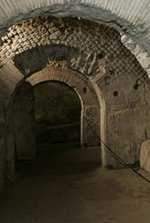
    Cities of the Underworld - Paris Catacombs

    The History Channel

    May 14, 2007

    Cities of the Underworld - Paris

    Satellite Imaging Corporation provided high resolution QuickBird satellite image data for the center of Paris.

    From the program description: Beneath the hustle and bustle of Paris streets are a world of snaking quarries, hidden catacombs, and mushroom-harvesting tunnels. Even Paris' 10.5 million residents have no idea they live on top of nearly 20 centuries of history carved into the limestone foundation below.

    Documentaries

    National Gallery - London, United Kingdom

    Rubens Pain and Love

    Rubens Pain and Love

    IKONOS natural color high resolution satellite image data, as well as image processing services, were provided with image data for historic districts in Rome, Italy.

    Publications

    Men's Health Magazine, Germany — April, 2003
    Men's Health Magazine, Spain — July, 2003
    Men's Health Magazine, Portugal — September, 2003

    Men's Health

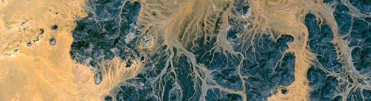
    Satellite Imaging Corporation provided LANDSAT 7 +ETM satellite images with water enhanced processing for various islands in the Mediterranean Sea. The images were published in Men's Health Magazine.

    Miscellaneous Media

    Satellite Imaging Corporation Delivers IKONOS Imagery For Microsoft Australia Day Event - View article here.

    Australia Day is treated with ambivalence by those who consider the anniversary of the foundation of one colony irrelevant to the overall history of Australia. Some Western Australians are quick to point out that Western Australia was not even claimed by Britain until September 19, 1829, while the eastern part of Australia had been claimed much earlier, in 1770.

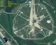
    Space Shuttle Endeavour Captured by GeoEye-1 Satellite Sensor on Launch Pad 39A in Preparation of Last Voyage - View article here.

    After 30 years of spaceflight, more than 130 missions, and numerous science and technology firsts, NASA’s space shuttle fleet will retire and be on display at institutions across the country to inspire the next generation of explorers and engineers.

    Satellite Imaging Corporation is an official Value Added Reseller (VAR) of imaging and geospatial data products for:
    A Twenty First Century Aerospace Technology Value Added Reseller
    Satellite imagery can be applied within many industries. Please choose one to learn more.
    • Energy
      • Mining
      • Oil and Gas
      • Pipeline and Transmission
    • Engineering and Construction
    • Defense and Security
    • Environmental Management
    • Media and Entertainment
    • Natural Resources
    • Tourism
    GeoEye-1 WorldView-1 WorldView-2 Pleiades-1A QuickBird IKONOS SPOT-6 SPOT-5 RapidEye ASTER LANDSAT-7
    • Contact
    • Satellites
    • Gallery
    • Applications
    • Services
    • About
      • Terms of Use
      • Privacy Policy
      • Site Map

    Copyright © 2001-2017 Satellite Imaging Corporation. All rights reserved.

    Facebook Twitter LinkedIn